Tide Charts Made Easy: New Wavve Boating App Simplifies Navigating Coastal Areas
Wavve Boating simplifies navigating tricky tidal regions for both new boaters and experienced captains alike.
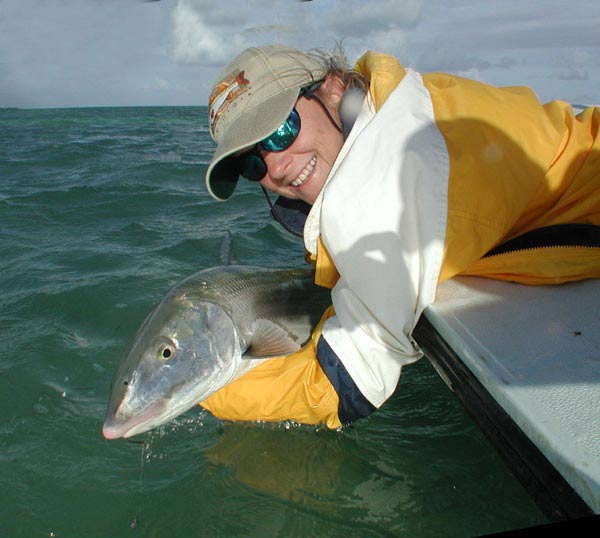
Even experienced boaters on trailerable, fairly shallow draft boats can sometimes find themselves running aground or getting stuck on an unexpected sandbar at low tide. Historically, interpreting tide tables in coastal regions has been a crucial, sometimes complicated process, with charts that must be studied carefully and prudently before a day out on the water. That's where the company Wavve Boating is trying to step in and help ease the pain for both new boaters and experienced captains alike with the help of some modern boat navigation technology.
Wavve has just introduced their new navigational tool for boaters, boat owners and captains that greatly simplifies and streamlines monitoring and predicting tides and water depths in coastal boating regions. Founder and CEO Adam Allore was inspired to launch the company in order to make boating easier, safer and more enjoyable for everyone, by tackling the problems he regularly experienced while growing up on the waters of the St. Lawrence River. We had a chance to ask Mr. Allore a few questions about the technology behind the app and how it works. Below is a transcript of our conversation with him.
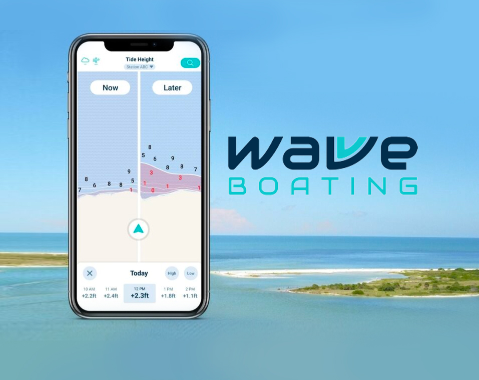
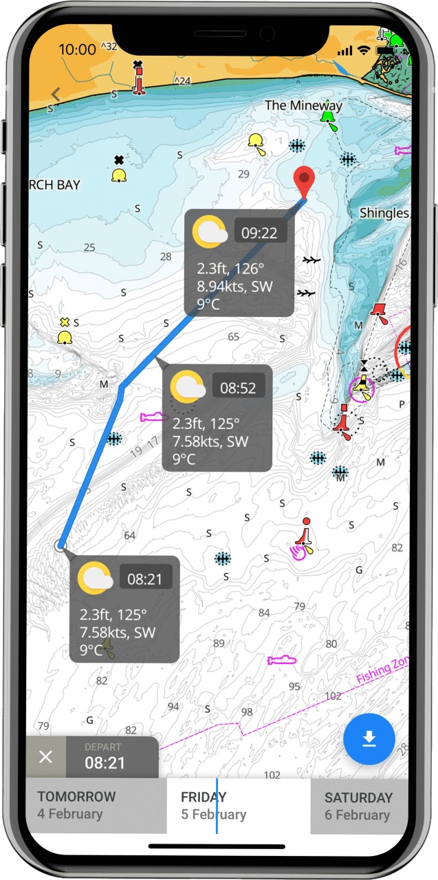
A GPS Navigation App for smartphones by Wavve Boating helps boaters predict and monitor water depths in tidal regions. Photo by Wavve Boating.
Q: What first gave you this idea, and what is the problem being solved?
Answer: We listened to our community! So many Wavve users wanted us to add a tides feature to the Wavve Boating app. We could have simply added a tide table/graph, but that isn't how we do it at Wavve - Why make our users reference a tide graph to see the water level offset and then calculate the water depth at 3pm? We innovated a solution that will show the water depth directly, no table referencing, or calculation required. Our latest innovation is a game changer for boating in tidal areas. We’ve removed the need for boaters to review tide tables by updating our maps in real-time based on data from 4300+ tidal stations. Boaters can see future water levels and review depths at later high/low tides, or any time of their choosing.
Q: What is the difference between the Wavve App and traditional onboard GPS navigation equipment?
Answer: A GPS is a near-essential piece of equipment for boating, but buying and installing a standalone GPS is an expensive proposition. Even when bought second-hand, the cost to install is an inconvenience. This is why boaters across the world are turning to their mobile devices to navigate by app.
Q: So how does the technology behind this tool work?
Answer: We connect to 4,300 water level stations maintained and monitored by NOAA (National Oceanic and Atmospheric Administration) for the US and CHS (Canadian Hydrographic Services) for Canada. Wavve Boating consolidates all the information these stations are reporting and presents it in a digestible way to our boating community. The Wavve GPS navigation app is available for both Android and IOS smartphones and the new water level/tides monitoring and prediction tool will now update in real-time to current water levels as well as predict water depths at future high and low tides.
Q: How are those stations powered and what technology do they employ?
Answer: Details on the stations can be found on NOAA's website.
Sidebar: NOAA's site explains,"A tide gauge, which is one component of a modern water level monitoring station, is fitted with sensors that continuously record the height of the surrounding water level. This data is critical for many coastal activities, including safe navigation, sound engineering, and habitat restoration and preservation. Today's recorders send an audio signal down a half-inch-wide sounding tube and measure the time it takes for the reflected signal to travel back from the water's surface. Data is still collected every six minutes, but while the old recording stations used mechanical timers to tell them when to take a reading, a Geostationary Operational Environmental Satellite (GOES) controls the timing on today's stations."
Q: Do you know how the tide gauge stations are kept stationary, i.e. are they moored or anchored
Answer: The stations are typically fixed to shore with a structure. [From NOAA: newer tide station enclosures are typically constructed atop a coastal pier on pilings, and are designed to protect sensitive electronics, transmitting equipment, and backup power and data storage devices.]
Q: What is the coverage of this service currently?
Answer: We cover major bodies of water in both the United States and Canada. We want to consolidate the most crucial boating information so no one has to search through multiple sources to decide if it’s safe to spend time on the water with family or friends.
Q: What does the future hold for Wavve?
Answer: As we continue to expand our market, the number of stations that we access with this feature will continue to grow. Innovating a better boating experience is at the core of what we do at Wavve Boating. The future is bright with the current renaissance in boating.
Q: How much does the app cost?
Answer: Wavve Boating is available via two subscription options of $4.99/month or $19.49/year. New users are offered a 14 day trial to see if the app is a fit for them. Wavve Boating’s Tides update is available now in the Google Play Store and Apple App Store. You can start a free, two-week trial or subscribe for $4.99 per month or $19.49 per year.
Q: Anything else you'd want boaters to know?
Answer: In addition to navigation features, Wavve Boating focuses on creating a boating community. Wavve Boating’s map is shared between users, so you can find your friends on the water and share your location, favorite spots, and activities. With a focus on the critical information the average boater needs on the water, you may want a supplemental app if you are interested in more complex chart data.